
💦 Simple and relaxing excursion parallel to the Ara River in the Bujaruelo ⛰ Valley

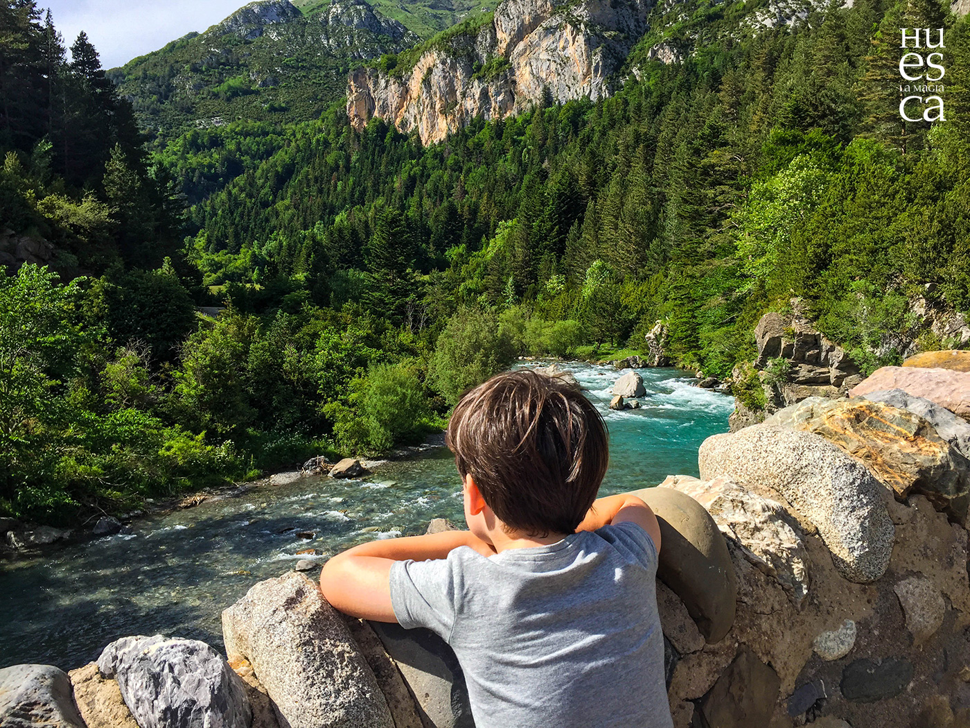
Today we are going on an excursion to the Cobatar Mixed Forest, between the bridge of Santa Elena and San Nicolás de Bujaruelo, in the Bujaruelo Valley.
This bucolic valley of Bujaruelo is located at the source of the Ara River and reaches the
Puente de los Navarros
. A valley full of many beautiful excursions and routes of all levels. In summer it is a good alternative for those looking for more tranquility.
Jorge Carrasco https://www.flickr.com/photos/145512641@N02/
It is a landscape where water, humidity and a multitude of meadows predominate to be able to lie down and look at the sky to find a golden eagle stalking the marmots or a bearded vulture.
In the meadow of Bujaruelo we find the hermitage of San Nicolás, the first temple that pilgrims found after crossing the port of Bujaruelo or Gavarnie from France through the medieval bridge of a single eye that is next to it.
EXCURSION to the mixed forest of Cobatar, between the bridge of Santa Elena and San Nicolás de Bujaruelo
Type of tour: Round trip | Time: 2 hours 35 minutes |
Slope: 295 meters | Positive slope: 295 meters |
Total Distance: 8 kilometers | Maximum height: 1371 meters |
Minimum height: 1213 meters | Severity of the natural environment: 2 |
Orientation in the itinerary: 2 | Difficulty in displacement: 2 |
Amount of effort: 2 |
The mixed forest of Cobatar is immersed in the impressive valley of Bujaruelo, drawn by the Ara River.
This excursion, between the bridge of Santa Elena and San Nicolás de Bujaruelo, has been for several generations the only path through the bottom of the valley, parallel to the river, until the construction of the current track.
To reach the starting point we must take the road that passes through Torla and leads to the meadow of Ordesa, but we, when reaching the bridge of the Navarros, we must turn left to enter the valley of Bujaruelo.
About 2 kilometers from the detour we reach the starting point of the route: the bridge of Santa Elena.
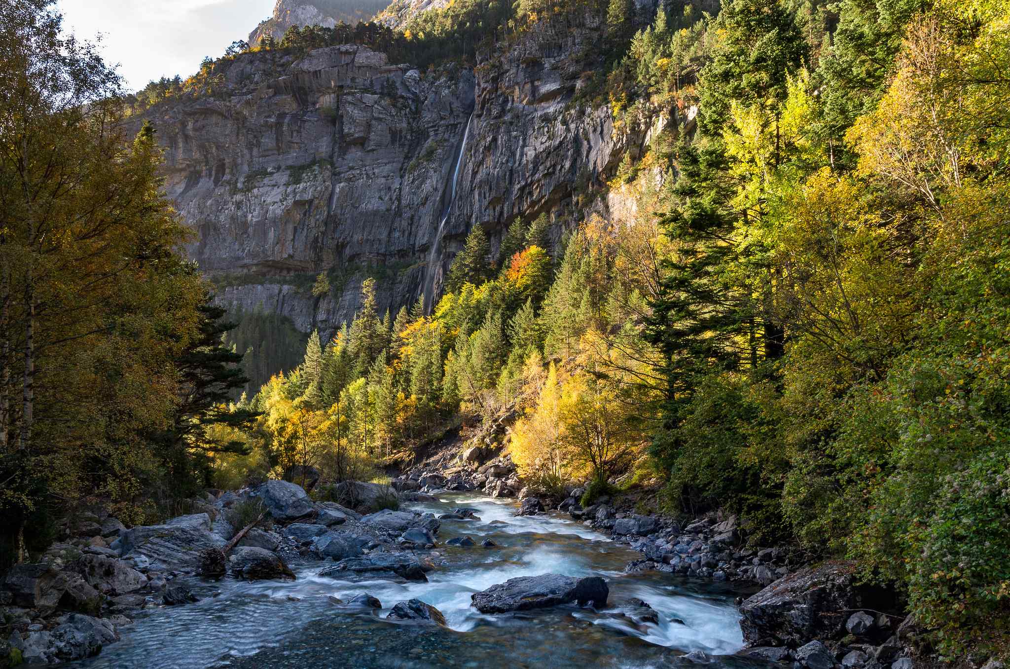
From the left bank of the river Ara, we start walking upstream, along a beautiful path that coincides with the route of the GR 11.
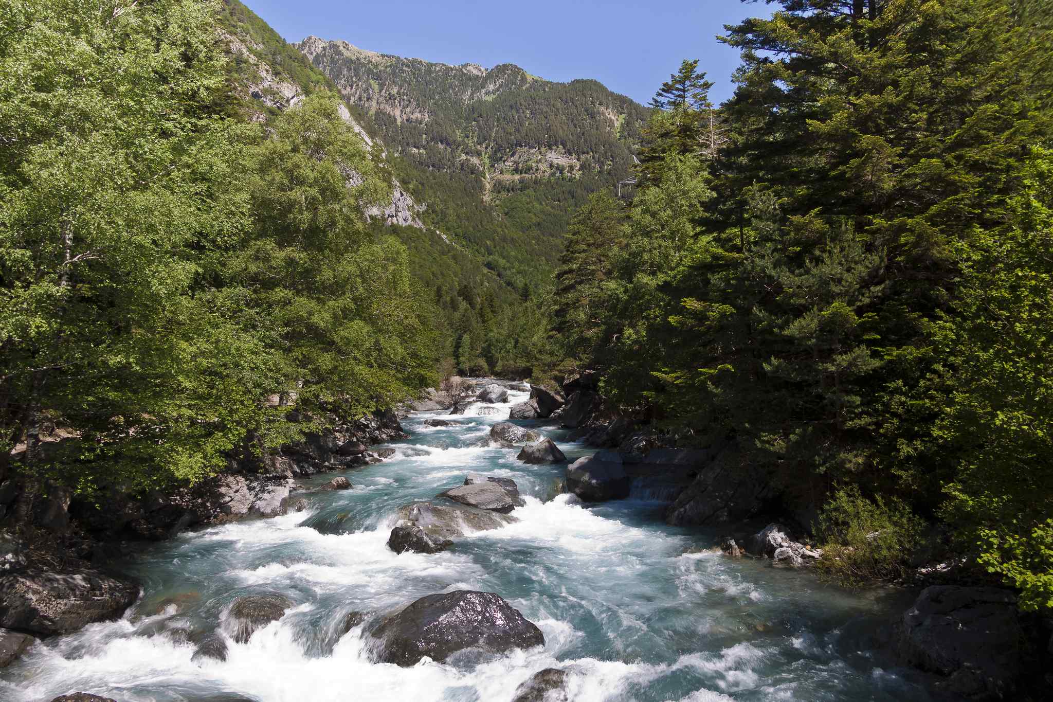
Almost immediately, we enter the Cobatar Forest, an impressive mixed forest of beech and fir, in which pines, rowans and birches also grow, with boxwood undergrowth, Pyrenean honeysuckle, ‘mezereón’ or holly, among many other shrubs.
After having traveled just over 3 kilometers, we reach the ravine of Escuzana, which descends sparkling down the slope to its mouth in the Ara River. We cross the bed of the ravine and continue in slight ascent and parallel to the river, and after crossing a long quarry we reach the Romanesque bridge of San Nicolás de Bujaruelo.
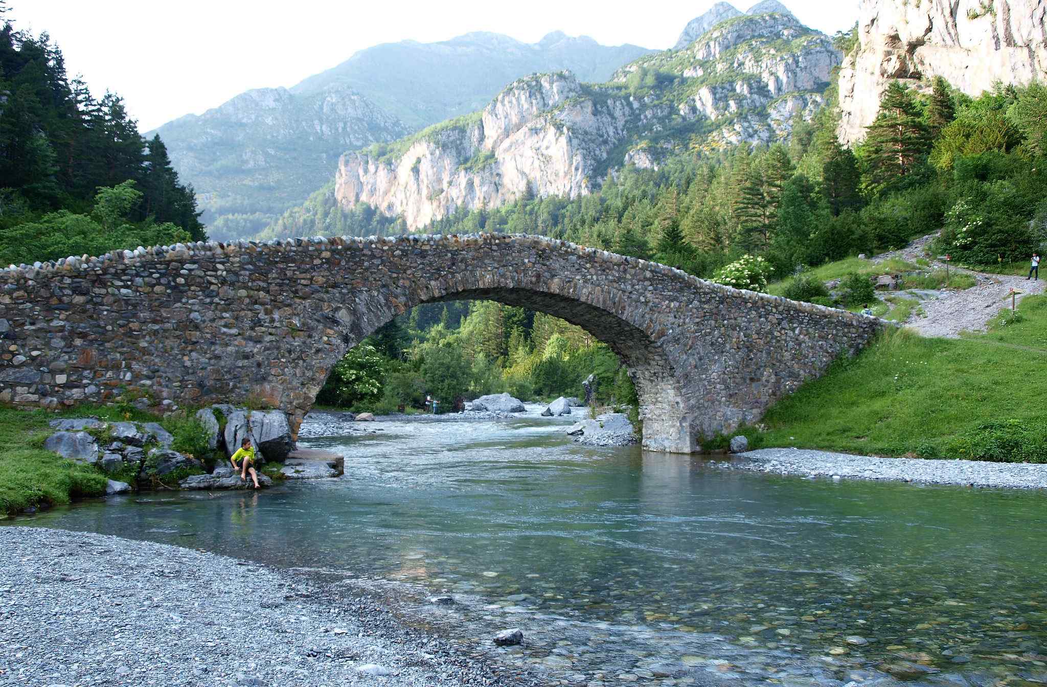
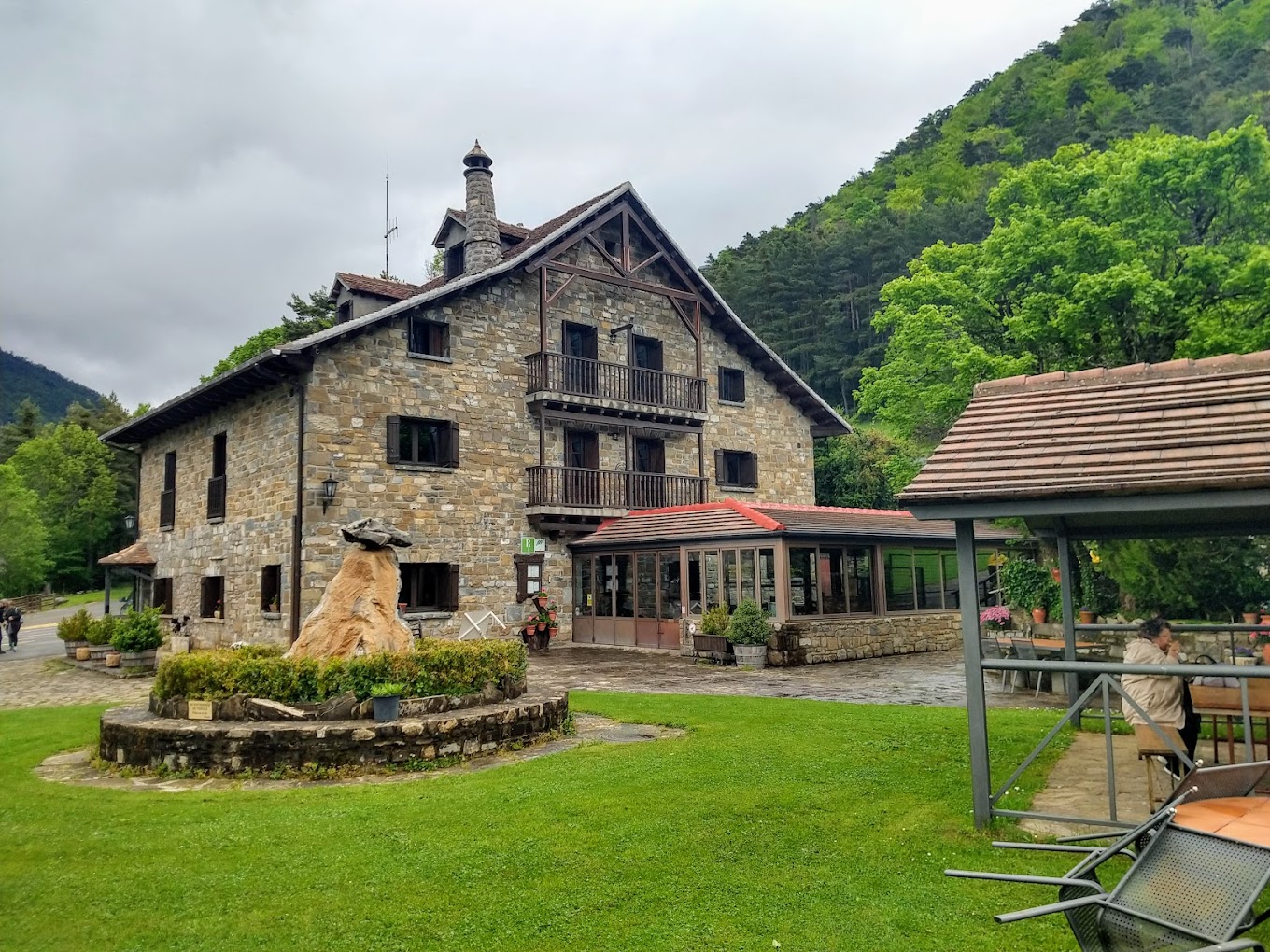
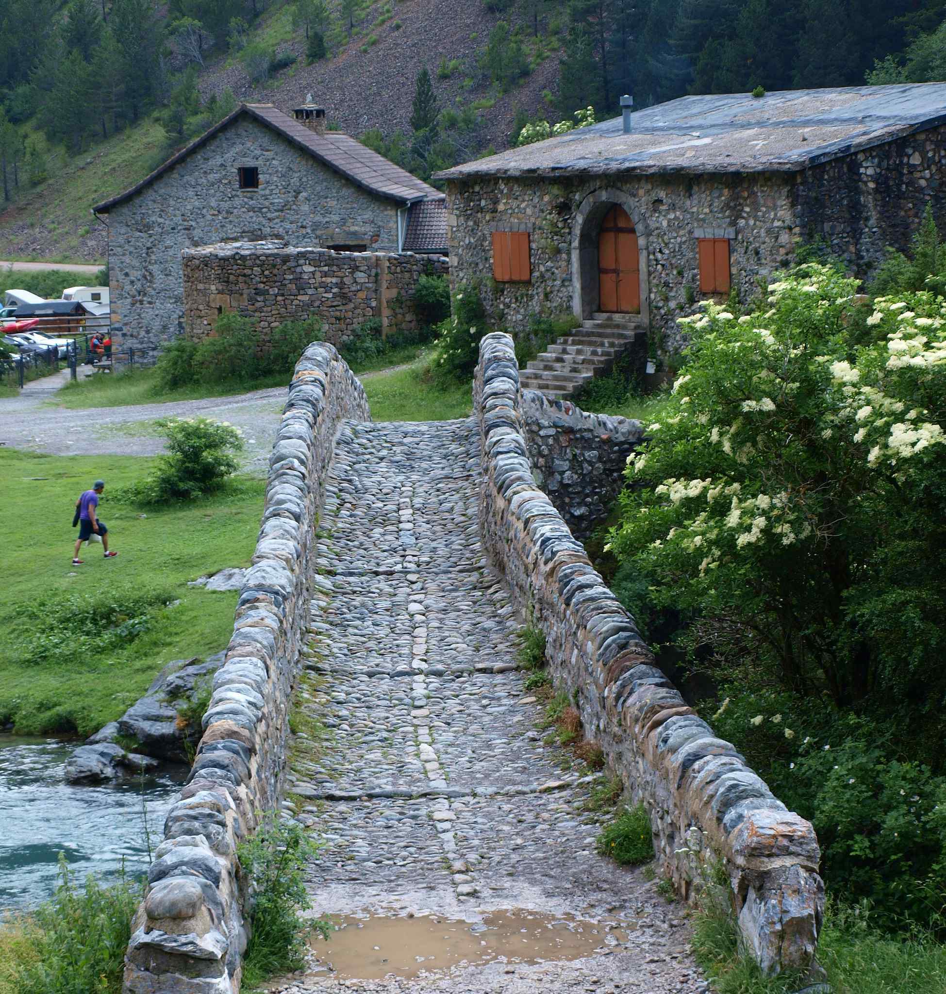
Next to the bridge, we leave the GR 11 to cross the river Ara and immediately reach the refuge of Bujaruelo, former hospital for pilgrims. This place was originally built in the twelfth century by the Order of knight monks of the Hospital of St. John the Baptist in Jerusalem, better known as Hospitallers or Sanjuanists, who came from the neighboring French valley of Gavarnie. Currently, it is a modern retreat with rooms and food service. From this corner of the Pyrenees that invites you to rest, we return to the starting point along the same path.
Jorge Carrasco https://www.flickr.com/photos/145512641@N02/
Source: gps.huescalamagia.es